The Crown of Karnataka

A Confluence of History, Heritage, and Harmony
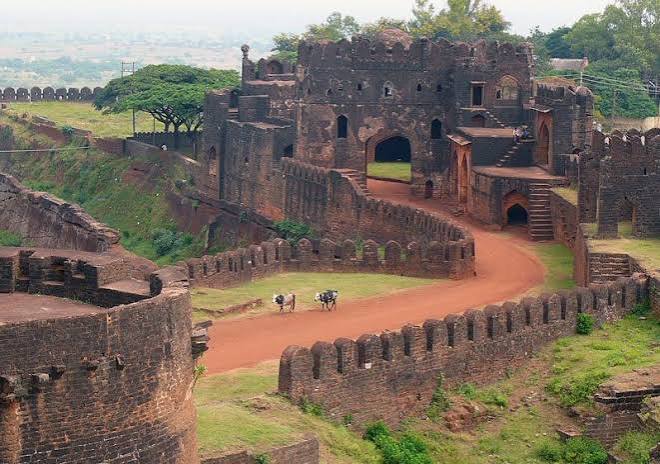
Bidar district stands prominently at the northernmost pinnacle of Karnataka, serving as a historic gateway where rich heritage, diverse cultural traditions, and vibrant communities intersect. Perched on a picturesque red laterite plateau, the district holds a storied past shaped by major dynasties including the Rashtrakutas, Chalukyas, Bahmanis, and Barid Shahis. Renowned worldwide for its extraordinary Indo-Islamic architecture, Bidar houses architectural marvels like the formidable Bidar Fort, Mahmud Gawan Madrasa, and the royal Bahmani Tombs. Beyond its historical grandeur, the region is a celebrated symbol of communal harmony and spiritual legacy, welcoming pilgrims to revered sites such as Gurudwara Nanak Jhira Sahib, the ancient Narasimha Jhira Cave Temple, and Basavakalyan, the cradle of the 12th-century Sharana Movement led by Mahatma Basaveshwara.
Demographics & Statistics
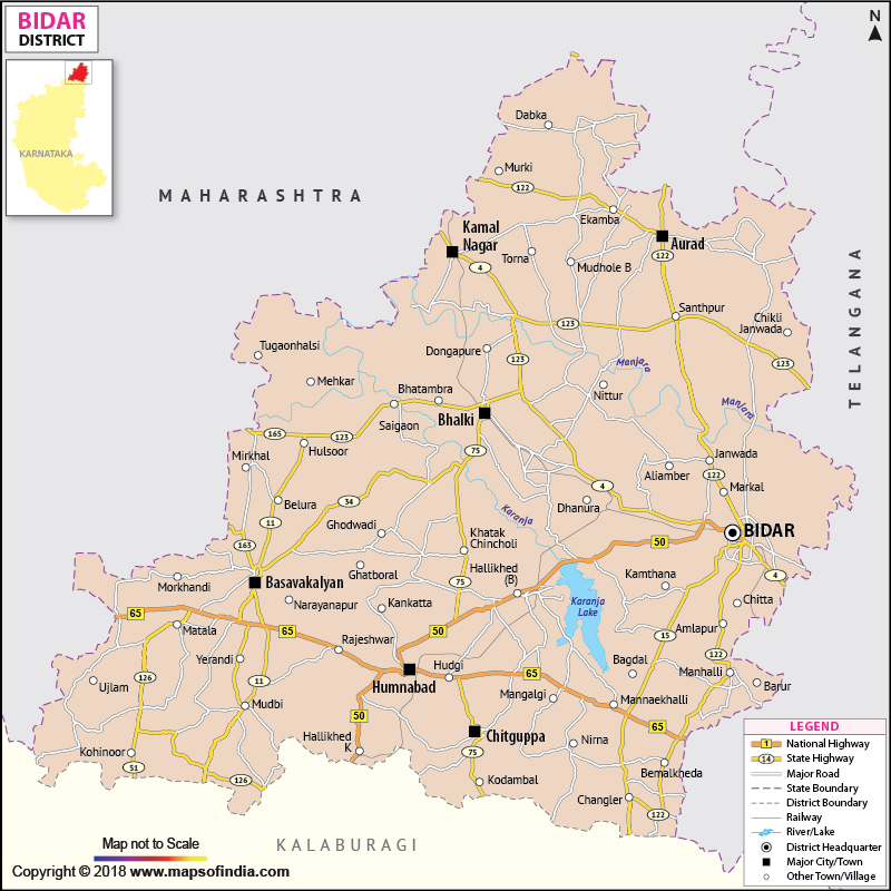
Administrative Divisions of Bidar District
Bidar
Bidar is the district headquarters and an important administrative, historical and cultural centre of the district.
District HeadquartersBasavakalyan
Basavakalyan is a historic town known for its association with the social and cultural movements of the 12th century.
TalukBhalki
Bhalki is an important administrative and agricultural region situated in the northern part of Bidar District.
TalukHumnabad
Humnabad is a prominent town and administrative centre known for its religious and cultural significance.
TalukAurad
Aurad is an important northern taluk of Bidar District with agriculture playing a significant role in the local economy.
TalukChitgoppa
Chitgoppa is an administrative area of Bidar District serving local communities and surrounding rural regions.
TalukBidar District Population Chart
Population Profile and Demographic Distribution of Bidar District
Bidar District has a diverse population spread across urban and rural areas.
According to Census 2011-based district statistics, the total population of Bidar was 17,03,300.
The district has a significant rural population, with agriculture and allied activities supporting many communities.
Urban centres such as Bidar city, Basavakalyan, Bhalki and Humnabad contribute to the district’s growing urban population.
The district’s population is distributed across 8 taluks, each with its own administrative and socio-economic characteristics.
Bidar has a geographical area of approximately 5,448 square kilometres.
The population density is around 312 persons per square kilometre.
The district’s literacy rate was approximately 71.01% according to Census 2011.
Demographics Charts
| Demographic Indicator | Bidar District |
|---|---|
| Total Population | 17,03,300 |
| Male Population | 8,70,665 |
| Female Population | 8,32,635 |
| Rural Population | 12,77,348 |
| Urban Population | 4,25,952 |
| Geographical Area | 5,448 sq. km |
| Population Density | 312 persons/sq. km |
| Revenue Divisions | 2 |
| Taluks | 8 |
| Gram Panchayats | 186 |
| Villages | 635 |
Bidar District Measurements
| Measurement | Bidar District |
|---|---|
| 📐 Geographical Area | 5,448 sq. km |
| 👥 Total Population | 17,03,300 |
| 🏘️ Population Density | 312 persons/sq. km |
| 🗺️ Revenue Divisions | 2 |
| 🏛️ Taluks | 8 |
| 🏢 Hoblis | 30 |
| 🌳 Gram Panchayats | 186 |
| 🏘️ Villages | 635 |
| 🏙️ Urban Local Bodies | 6 |
| 📚 Literacy Rate | 71.01% |
Previous History of Bidar District
| Historical Period / Event | Important Information |
|---|---|
| 🏺 Early History | Bidar has a long history associated with several ancient and medieval kingdoms of the Deccan. |
| 👑 Western Chalukyas | The region was influenced by the Western Chalukya period and became part of the wider Deccan political landscape. |
| 🏰 Bahmani Sultanate | Bidar became the capital of the Bahmani Sultanate in 1427, marking an important period in its history. |
| 🕌 Mahmud Gawan’s Period | Mahmud Gawan, an important Bahmani statesman, contributed significantly to Bidar’s educational and architectural development. |
| 🎨 Rangin Mahal | Rangin Mahal is one of the notable historic structures representing the artistic and architectural heritage of medieval Bidar. |
| ⚔️ Barid Shahi Dynasty | After the decline of the Bahmani Sultanate, Bidar became the centre of the Barid Shahi dynasty. |
| 👑 Adil Shahi & Mughal Period | Bidar subsequently came under the influence of the Bijapur Adil Shahis and later the Mughal Empire. |
| 🇮🇳 Nizam’s Rule | Bidar became part of the Hyderabad State under the Nizams and remained connected with Hyderabad’s administration. |
| 🗺️ Reorganisation of States | Following India’s state reorganisation, Bidar became part of Mysore State, which was later renamed Karnataka. |
| 🌟 Modern Bidar | Today, Bidar is known for its historic monuments, Bidriware handicrafts, religious sites, cultural heritage and tourism. |
Revenue Administration of Bidar District
| Revenue Administration | Bidar District |
|---|---|
| 🏛️ Revenue Divisions | 2 |
| 🗺️ Taluks | 8 |
| 🏢 Hoblis | 30 |
| 🌳 Gram Panchayats | 186 |
| 🏘️ Villages | 635 |
| 🏙️ Urban Local Bodies | 6 |
| 📍 District Headquarters | Bidar |
| 🏛️ Revenue Division Headquarters | Bidar & Basavakalyan |
| 👨💼 District Administration | Deputy Commissioner (DC), Bidar |
| 📋 Taluk Administration | Tahsildar / Taluk Administration |